Navigating the New I-70 Overpass in Forestdale
Transportation, Community Update
Navigating the New I‑70 Overpass in Forestdale: What Drivers Need to Know
The I‑70 highway expansion and new overpass near Forestdale are reshaping how drivers travel through Foristell, Wright City, and Warrenton. Here’s a clear look at construction progress, changing traffic patterns, and how to stay safe and informed as the project moves forward.
Ongoing Construction Progress on the I‑70 Overpass
The new I‑70 overpass in the Forestdale area is a key part of Missouri’s broader effort to improve the I‑70 corridor between communities like Foristell, Wright City, and Warrenton (MoDOT). Crews are steadily moving from heavy earthwork and bridge foundations into more visible stages: setting beams, pouring bridge decks, and tying the new structure into existing ramps and local roads. Alongside the bridge work, contractors are grading shoulders, installing drainage, and preparing the corridor for additional lanes that will carry more traffic with improved safety and capacity.
Widening I‑70 to a Six‑Lane Corridor
A central feature of this project is the transformation of I‑70 into a six‑lane corridor through this stretch. Where drivers once had a single lane in each direction plus a passing lane in some segments, the expanded design provides three lanes each way, improving traffic flow and reducing bottlenecks that have long frustrated commuters and freight operators. According to statewide I‑70 improvement plans, the goal is to relieve congestion, enhance safety, and support long‑term economic growth along the route (MoDOT – I‑70 Expansion).
While the finished highway will feel wider and more predictable, the construction phase can feel just the opposite. Temporary striping, narrow shoulders, and short‑term closures are all part of the process of adding new pavement while keeping traffic moving.
Lane Shifts, New Patterns, and Changing Traffic Flow
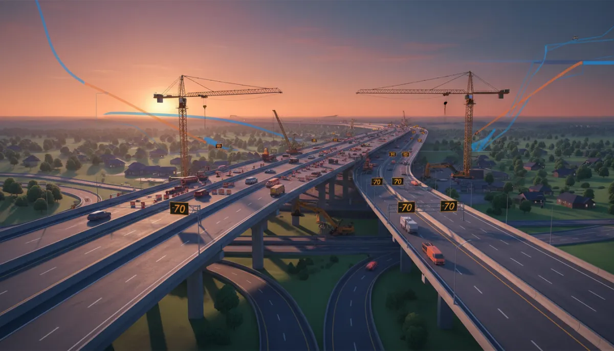
Drivers traveling through Forestdale and nearby interchanges will notice frequent lane shifts as crews work in stages. The traffic diagram for this project shows eastbound and westbound lanes weaving slightly to one side of the existing roadway, then crossing back as work progresses on different segments of the overpass and mainline pavement. These shifts allow contractors to build new lanes and bridge sections while keeping at least one lane open in each direction.
The map also highlights temporary merge points, reduced‑speed zones, and areas where entrance and exit ramps tie into the new alignment at steeper angles than usual. As a result, traffic flow may feel tighter, with shorter gaps for merging and less room to correct mistakes. Reduced speed limits through the corridor are designed to account for these conditions and protect both drivers and workers.
Active Work Zones and Why Extra Caution Matters
The Forestdale overpass area is currently an active work zone, with crews present during both daytime and overnight hours. The traffic diagram indicates multiple work areas operating at once: bridge construction on the overpass itself, paving crews on the mainline, and utility or drainage work along the shoulders. Concrete barriers, cones, and temporary signage guide vehicles through these narrow corridors.
In these conditions, even small distractions can have serious consequences. Reduced sight distances near equipment, sudden braking as drivers approach lane drops, and the presence of workers just feet from live traffic all make it essential to obey posted work‑zone speeds, avoid phone use, and leave extra following distance.
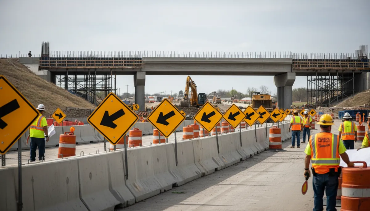
Narrow lanes, barriers, and nearby crews make patience and slower speeds vital in this corridor.
New Intersections and Local Access: Stay Alert, Not on Autopilot
One of the most important takeaways from the project map is the changing pattern of intersections and access roads serving Forestdale, Foristell, Wright City, and Warrenton. As the overpass and frontage roads are realigned, some familiar turn lanes and crossings are temporarily closed, while new intersections and signalized access points are introduced to keep local traffic connected to I‑70.
For example, a side road that once met the highway at a simple stop‑controlled T‑intersection may now connect via a new signal or ramp, or be routed to a different crossing point. The diagram shows these changes with arrows and labels indicating “new intersection,” “temporary access,” or “future connection.” It is crucial not to rely on muscle memory alone: drivers should watch for new stop signs, yield points, and signal locations, especially when traveling between neighborhoods and local businesses near the overpass.
💡 Safety Reminder: Treat every drive through the work zone as if it’s your first. Look ahead for new signs, fresh striping, and unexpected turns rather than assuming the route is unchanged.
Local Impact on Foristell, Wright City, and Warrenton
Communities along this stretch of I‑70 are already feeling the project’s mixed impacts. In the short term, residents of Foristell, Wright City, and Warrenton are navigating detours, construction noise, and longer travel times as they commute, shop, or get kids to school. Some local businesses report customers hesitating to cross active work zones or unsure which exits are open on a given day.
Over the longer term, however, the I‑70 expansion is expected to bring substantial benefits, from smoother freight movement to stronger economic opportunities along the corridor (Missouri Economy – I‑70 Impact). Improved access can support new development, help existing businesses draw customers from a wider area, and potentially boost property values once construction is complete. The key for local communities is getting through the construction period safely and with as little disruption as possible.
Using the Traffic Diagram and Map to Plan Your Drive
The provided traffic diagram and project map are more than just technical drawings—they are practical tools for everyday drivers. By reviewing where lanes narrow, where traffic shifts across the median, and how local roads tie into the new overpass, you can anticipate slow‑downs and choose the safest, most efficient route. Pay close attention to:
Marked lane shifts and crossover points between eastbound and westbound lanes.
Symbols showing active work zones and reduced‑speed segments.
Labels for new or temporary intersections and access points serving nearby neighborhoods and businesses
Stay Informed, Stay Cautious, and Support the Project’s Success
As the I‑70 overpass in Forestdale and the surrounding six‑lane corridor take shape, every driver plays a role in keeping the project on track. Staying informed through MoDOT updates, local news, and official project pages helps you avoid surprises and plan around major closures or traffic pattern changes. Many agencies now provide email alerts, social media posts, and construction calendars specifically for I‑70 improvements.
Above all, approach the work zone with patience and caution. Slow down, follow posted signs, and watch closely for new intersections and lane shifts. By driving alert and sharing accurate information with friends, family, and coworkers, you help protect workers, reduce crashes, and ensure that Foristell, Wright City, Warrenton, and the wider region can start enjoying the full benefits of a safer, more reliable I‑70 as soon as construction is complete.


